NLP-CV,Decument Recognition,Raster Vector Conversion,Raster Edit,AutoNest,Deep Learning,Chatbot on Prolog and LLM,High Level Image Procession,Video Image Proecssion,Geometric figure processing


■Geometric Figure Processing Achievements
<Features>
Geometry algorithm application technology developed through map inspection system for the Geospatial Information Authority of Japan

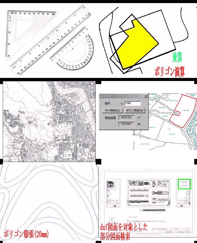
■2D Polygon ArithmeticCalculating the union, intersection, and difference of polygons |
■Intersection CalculationCalculating the intersection between polygons, polygon and polyline, and polyline and polyline |
■Polyline to Polygon ConversionExtracting polygons from line drawings and enabling calculations such as area calculation and determining if a point is inside or outside the region |
■Polygon Expansion and ContractionExpands and contracts polygons instead of scaling them |
■Convex HullConvex hull that surrounds any given geometric object (e.g., convex hull that surrounds a text area) |
■Scanline ConversionConverts polygons into filled raster images |
■Topographic Map Coordinate ConversionConverts between BL (Blue Lamp) coordinate system and UTM (Universal Transverse Mercator) coordinate system |